THINGS TO DO > GREAT OUTDOORS
Covered Bridges
There are more than a dozen historic covered bridges within an hour’s drive in any direction, many that maintain daily traffic and routes from one side of villages to another. Truss designs vary. Many bridges in the White Mountains utilize Paddleford trusses, which were originated by Peter Paddleford of Littleton. Each covered bridge is unique and holds many special and scenic features.
Bath, New Hampshire is known as the “Covered Bridge Capital” of New England, and quite possibly of the country. Bath is a small village with a population of only 1,000 residents, but tiny as Bath is, they can brag about 3 very special covered bridges in their village.

Bath Village Covered Bridge
Location: Route 302, Bath, NH
The current structure is the fifth bridge to stand on this site. The first was constructed in 1794 and was demolished by a flood It was replaced in 1806 and demolished by floods again in 1820 and 1824. This replacement was destroyed by fire in 1830. The current bridge was completed in 1832 with the addition of two stone abutments and piers. The Bath Bridge is listed on the National Register of Historic Places and is the longest covered bridge in NH at 400 feet. It is also the oldest working covered bridge in existence today as it is the only traffic connection to both sides of Bath Village within 10 miles either way. The bridge is posted as a one lane bridge for six tons, passenger cars only. Its location is beside the oldest general store in America and the cornerstone of the historic village square on Route 302.
Bath-Haverhill Covered Bridge
This is the oldest operating covered bridge in America, and is the oldest authenticated covered bridge in New Hampshire. It was built with a separate covered passageway for pedestrians, which very few covered bridges had. Built in 1829, it is the first and only bridge to ever be built at this site. The bridge is located one-quarter mile north of U.S. Route 302 in Woodsville Village on N.H. Route 135 over the Ammonoosuc River. The style is salt box type; town lattice truss with arches (two pan).
Swiftwater Covered Bridge
Location: Route 112 E. of Route 302, or W. of Exit 32 off I-93
Built in 1849, this is one of the most picturesque, covered bridge in all of New England. Tthe famous covered bridge overlooks Swiftwater Falls, where the Wild Ammounoosuc River cascades 15 feet over rocky ledges and into a series of deep, cool pools. Along the length of the Swiftwater covered bridge are viewports allowing pedestrians to take in views of the Wild Ammonusuc River both up and down stream. Of Paddleford Truss construction, The Swiftwater Covered Bridge is maintained by the town of Bath, NH and one of only 20 remaining Paddleford Truss bridges in the world. This Swiftwater Covered Bridge is the fourth covered bridge to cross the Wild Ammonoosuc River at this location. The first was built in 1810, carried away in 1818 by a flooding Wild Ammonusuc River. The second Swiftwater was destroyed by another flood in 1828. A third covered bridge at Swiftwater was erected in 1829. In 1849 the bridge was dismantled and replaced by the current fourth Swiftwater Covered bridge. Listed on the National Register of Historic Places, one can enjoy more fully the beauty of the location, drive across the bridge and park on the large dirt parking on the left. A short path leads through the underbrush and out onto the ledges and rocky beach of the Wild Ammonoosuc River.
Clark’s Bridge
North Woodstock, NH
Location: East of U.S. Route 3 in Clark’s Trading Post on Clark’s Short Steam Railroad
Clark’s Bridge was originally built in Barre, Vermont, in 1904 as a part of the Barre Railroad, to span the Winooski River. In 1960 the railroad line and the covered bridge were abandoned. The bridge was dismantled in East Montpelier and taken to its present site. The bridge was reassembled on dry land next to the Pemigewasset River. It was positioned over the river in 1965 and is still used as a part of Clark’s Short Steam Railroad. It appears to be the only Howe railroad bridge left in the world.
Sentinel Pine Bridge
Lincoln, NH
Location: in the Flume Gorge, Franconia Notch State Park
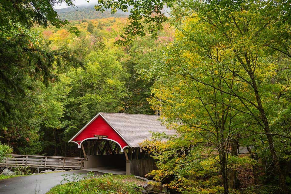
This bridge, built in 1939, is located in Franconia Notch State Park and it carries a hiking trail over the Pemigewasset River just a short distance from the Franconia Notch Visitors Center. It is considered a “romantic” structure, meaning that it is an authentic reproduction of a historic covered bridge, but built of materials other than timber, with no truss or arch. The covered portion of the bridge is 60 feet long. This bridge along with the Flume Bridge are all part of some of the natural attractions that make up the area generally known as the Flume.
Flume Bridge
Lincoln, NH
This c. 1886, 50-ft. bridge spans the Pemigewasset River in Franconia Notch State Park. Of Paddleford truss construction, it has a hiker’s walkway on its north side (admission charged).
